The renewed global focus on the safety of tailings storage facilities (TSFs) has highlighted the value of 3D geological ground modelling, especially in enhancing characterising of sites and effectively communicating subsurface site conditions.
Delivering a paper at a recent seminar of the South African Institute for Engineering and Environmental Geologists (SAIEG), SRK Consulting senior engineering geologist Hennie Booyens emphasised that 3D models were “not just pretty pictures.”
“A visual representation of the site conditions can often be worth a thousand words,” said Booyens. “These models should in fact be considered as powerful data management tools, especially as they can be updated as and when new information becomes available.”
He pointed to the importance attached to site characterisation by the Global Industry Standard on Tailings Management (GISTM) – not just during the various design stages but throughout the life cycle of the TSF. He said the engineering geologist plays a critical role in ensuring that adequate characterisation of the ground profile is conducted.
“Our discipline ensures that all geological and geotechnical aspects are sufficiently addressed and presented, so that design engineers have a thorough understanding of the site conditions,” he explained.
Engineering geologists typically conduct various levels of geotechnical investigations, in line with the South African Institution of Civil Engineers (SAICE) Site Investigation Code of Practice. These investigations take place at different stages of a project life cycle, from pre-feasibility through to post-construction and even remedial stages.
While pre-feasibility work includes desk studies and site walkovers, the feasibility stage could require a more comprehensive desk study, limited intrusive investigations such as test pitting and drilling. Design level investigations would typically need geophysics work, borehole drilling and laboratory testing, while the detailed design stage calls for additional in-situ testing and even large-scale trials (if required), in addition to further pitting, drilling and laboratory testing. Monitoring, testing and inspection of open excavations are among the tasks conducted during construction stage.
By utilising 3D geological ground modelling techniques, comprehensive and detailed representations of the subsurface can be created. This enables a more thorough understanding of the geological features, structural complexities, and soil properties of a given site. Such precise characterization is essential for assessing the stability and integrity of TSFs, thereby aiding in the identification and mitigation of potential risks.
Furthermore, 3D geological ground models offer enhanced visualisation capabilities, facilitating effective communication among stakeholders involved in TSF management and decision-making processes. By presenting geotechnical data and site conditions in a clear and intuitive manner, 3D models enable improved comprehension, collaboration, and informed decision-making, ultimately contributing to enhanced safety and risk management in the design, operation, and monitoring of TSFs.
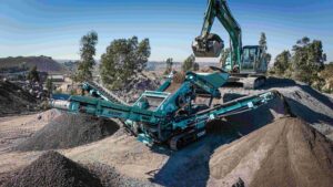
Using the example of a recent TSF project on a South African platinum mine, Booyens highlighted the critical importance of as-built drawings and surveys in elements such as the foundation footprint preparation and the starter wall foundation excavations. Logging and inspections along open excavations was also critical, as a larger exposure of the underlying material provides invaluable additional insight into the site conditions.
“I would recommend working on a 3D model prior to the construction of the TSF,” he said. “This helps design engineers to understand not only the underlying ground conditions, but also informs them on the larger scale geomorphological setting of the site.”
He said that working with the data in a 3D model has another valuable benefit. By allowing the engineering geologist to work effectively with all available data, they are better able to identify any gaps; these gaps then guide the planning of future investigations, which can focus on the identified areas of interest.
Booyens’ presentation was titled ‘3D Geological ground modelling: Practical examples of tailings storage facility footprint investigations’ and was delivered as part of SAIEG’s seminar series on Engineering Geology in Practice.